Plan the island by area
Places to visit in Martinique: choose regions and build an itinerary
Martinique is more than a sequence of beaches. Choose your priorities and base first, then keep each day within one area so you spend time visiting rather than crossing the island.
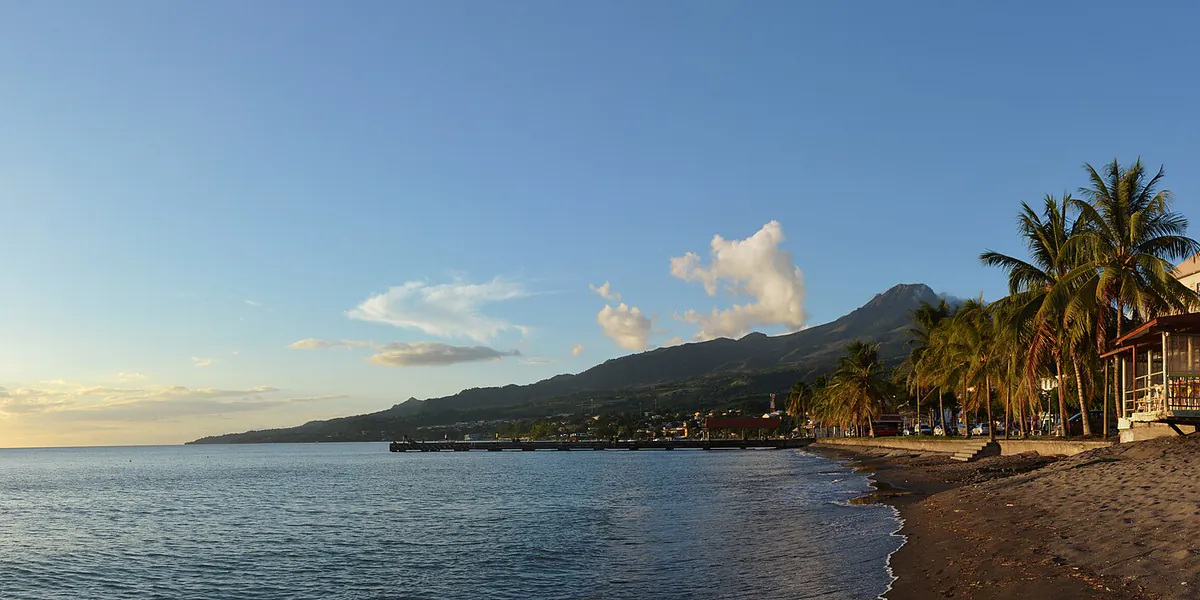
The most useful first decision is not “which beach should I see?” but which combination of landscapes and experiences matters most. The volcanic north, urban centre, beach-oriented south and Atlantic coast do not behave like districts of one city. Roads follow the terrain, congestion varies and local rain can change a hike without spoiling the day elsewhere.
Choose an area before filling the schedule
| Area | What it offers | Days that fit together | Main caution |
|---|---|---|---|
| North Caribbean | Saint-Pierre, volcanic history, dark sand, distilleries and Pelée views | Historic Saint-Pierre, one heritage site and a coastal stop | Terrain, rain and trail conditions |
| Centre | Fort-de-France, Schœlcher Library, markets, museums and transport links | A central walking route, market, then a cross-bay ferry if the service fits | Traffic, parking and same-day opening arrangements |
| South Caribbean | Les Anses-d’Arlet, Les Trois-Îlets, Le Diamant and sheltered coves | One main beach, a town and a memory site | Crowds, parking and sea state |
| Far south | Sainte-Anne, Les Salines and coastal trails | An early beach, short walk and town stop | Heat, little shade and sargassum depending on the area |
| Atlantic coast | Le François, Fonds Blancs, Caravelle, mangroves and trade winds | One supervised boat trip or a Caravelle hike, not both at a rush | Wind, swell and weather-dependent services |
For a short stay, choose two areas rather than aiming to tour the whole island. On a longer trip, changing base once can remove several return journeys. The where-to-stay guide compares bases by these travel patterns.
Build each day around one fixed commitment
A sea trip, substantial hike or timed guided visit is the main commitment. Add one or two flexible stops in the same area: a town, beach or market. This leaves room when roads, weather or access take longer than expected.
Coherent examples include:
- Saint-Pierre: begin with the historical context, explore the remains, then choose one north Caribbean stop;
- Fort-de-France: Schœlcher Library, town centre and market, with the waterfront as breathing space;
- Le François: take the confirmed operator-led boat trip, then return without adding an island crossing;
- Sainte-Anne: choose a beach for the conditions, add a heat-appropriate coastal walk, then visit the town;
- Caravelle: select a weather-suitable trail, then stay in the area for Tartane and a meal.
A day combining Mount Pelée, Les Salines and Caravelle looks varied in a list. On the ground, it is mostly a day in the car.
Beach, mountain and sea trips need different weather decisions
The sky seen from the coast is not enough to decide on an ascent. Cloud, rain, wind and visibility can change quickly on Mount Pelée. For a boat trip, swell, wind, local restrictions and the professional’s decision matter more than a sunshine icon.
Before setting out:
- check the Météo-France warning page;
- ask the manager or provider whether the intended access is operating;
- keep a nearby, less exposed alternative;
- never enter a trail or the water when a closure, barrier or local instruction prohibits it.
UNESCO’s listing of the volcanoes and forests of Mount Pelée and the northern pitons recognises the area’s geological and biological value. It does not make the whole massif a recreation park: remain on authorised routes and carry out all waste.
A car helps, but should not dictate the whole trip
A car makes distant beaches and sights easier, but the driver should also be able to enjoy the day. Group stops, avoid crossing Fort-de-France at the busiest times when possible and save maps offline. Never leave luggage or documents visible in a vehicle.
Public transport is useful on some corridors, particularly in the centre and on cross-bay maritime links. It does not serve every trailhead or beach in the same way. Use the official Martinique Mobilités journey planner for a specific date and time, then check traffic information.
Use an adaptable framework, not a rigid itinerary
If nature is the priority
Set aside one northern day for Mount Pelée, another for Caravelle, then place beach visits according to sea conditions. Forest and ridges require different equipment from the coast.
If water is the priority
First compare beaches, then choose one supervised activity: scuba diving, mangrove kayaking or dolphin watching. Before paying, ask for the exact departure point, supplied equipment and weather policy.
If history and local life are the priority
Combine Saint-Pierre, Fort-de-France, a market and a distillery. These places tell different stories from different periods; take time to read the interpretation rather than collecting photographs.
Sources for checking your plan
- Martinique Tourism Committee: unmissable places, for identifying broad areas and opening individual listings;
- UNESCO: volcanoes and forests of northern Martinique, for heritage and environmental context;
- Martinique Mobilités, for routes, timetables and disruptions;
- Martinique Aimé Césaire Airport, for arrival and departure information.
Check again the day before: weather alerts, trail access, sea conditions, operation of your chosen site and the real route from your accommodation.
Useful points on the ground
Addresses and maps
Fort-de-France
97200 Fort-de-FranceMartiniqueThe central urban anchor for heritage, markets and transport connections.
Saint-Pierre
97250 Saint-PierreMartiniqueA north Caribbean base for the memory of 1902, Mount Pelée and volcanic landscapes.
Sainte-Anne
97227 Sainte-AnneMartiniqueA southern reference point for beaches, the coast and early starts toward Les Salines.
Tartane and the Caravelle peninsula
97220 La TrinitéMartiniqueAn Atlantic anchor for the reserve, trails, mangroves and Tartane village.